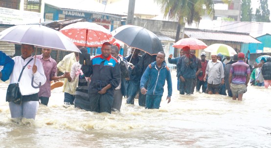
The County government of Nairobi has mapped out 463 places at risk of flooding ahead of the onset of the El Nino rains predicted to begin in October.
Nairobi County Chief Officer in charge of Disaster Management Bramwel Simiyu listed Kibera, Mathare, Njiru, and Ruaiamong 436 hotspots identified to be prone to flooding.
Speaking on Wednesday, Simiyu revealed that the County’s plan to evacuate residents residing in the areas is in progress to prevent the loss of lives and property in the sub-counties.
“By at large settlement along Nairobi River are at risk. The locations arranging from Kibera, Mathare, Mukuru to Waruku in Kileleshwa where there have been instances of floods previously,” he said.
“At the moment, without disclosing so many details, we are working on a budget that will cater for the 200, 000 people who are likely to be affected by the floods,” he added.
Did you read this?
Simiyu stated that a committee had been established to help with planning, emergency preparedness, and informing inhabitants of high-risk areas about the advantages of moving.
The committee will assist in locating alternative short-term housing for persons who will be moved from their current residences.
“As we engage the community sensitizing them why they should move from this location to another, we are sensitive knowing that this is their places they meet their daily needs, therefore they should understand why they are being moved and cooperate,” he said.
“Only on extreme cases that we may apply force to ensure they residents are moved to save lives.”
The National Kenya Meteorological Department issued an update saying El Nino is expected to occur during the October to December long rains season.